Because of you…

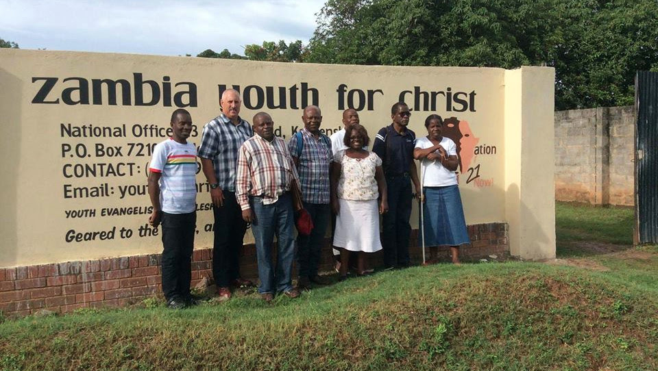
Youth for Christ in Zambia desires to develop a team of people who will disciple others to be godly leaders and to develop a prayer network who will pray for the lost youth in Zambia. Current ministries include clubs, music, drama, an annual trade fair, many types of outreaches and crisis pregnancy care.

Prayer Needs

  • Raising of faithful laborers for the ministry.
  • Strength and good health for the volunteers involved in direct ministry.
  • Establishment of Youth for Christ ministries in rural and remote areas.
  • Peace and stability in the nation and for God’s guidance for our political leaders.

About Zambia

Zambia

Location of Zambia

Introduction

The territory of Northern Rhodesia was administered by the [British] South Africa Company from 1891 until it was taken over by the UK in 1923. During the 1920s and 1930s, advances in mining spurred development and immigration. The name was changed to Zambia upon independence in 1964. In the 1980s and 1990s, declining copper prices and a prolonged drought hurt the economy. Elections in 1991 brought an end to one-party rule, but the subsequent vote in 1996 saw blatant harassment of opposition parties. The election in 2001 was marked by administrative problems with three parties filing a legal petition challenging the election of ruling party candidate Levy MWANAWASA. The new president launched an anticorruption investigation in 2002 to probe high-level corruption during the previous administration. In 2006-07, this task force successfully prosecuted four cases, including a landmark civil case in the UK in which former President CHILUBA and numerous others were found liable for USD 41 million. MWANAWASA was reelected in 2006 in an election that was deemed free and fair. Upon his abrupt death in August 2008, he was succeeded by his Vice President Rupiah BANDA, who subsequently won a special presidential election in October 2008.

Geography

Location

Location: Southern Africa, east of Angola
Geographic Coordinates: 15 00 S, 30 00 E

Area

Total Area: 752,618 sq km Rank: 39
Land Area: 743,398 sq km
Water Area: 9,220 sq km
Comparison: slightly larger than Texas
Land Boundaries: 5,664 km
Bordering Countries: Angola 1,110 km, Democratic Republic of the Congo 1,930 km, Malawi 837 km, Mozambique 419 km, Namibia 233 km, Tanzania 338 km, Zimbabwe 797 km
Coastline: 0 km (landlocked)

Climate

tropical; modified by altitude; rainy season (October to April)

Terrain

mostly high plateau with some hills and mountains

Elevations

Lowest Point: Zambezi river 329 m
Highest Point: unnamed location in Mafinga Hills 2,301 m

Natural Resources

copper, cobalt, zinc, lead, coal, emeralds, gold, silver, uranium, hydropower

Land Use

Arable land: 6.99%
Permanent Crops: 0.04%
Other: 92.97% (2005)
Irrigated Land: 1,560 sq km (2003)
Renewable Water Resources: 105.2 cu km (2001)
Total Freshwater withdrawal (domestic/industrial/agricultural): 1.74 cu km/yr (17%/7%/76%)
Freshwater Withdrawal Per Capita: 149 cu m/yr (2000)

Environment

Natural Hazards: periodic drought; tropical storms (November to April)
Environmental Issues: air pollution and resulting acid rain in the mineral extraction and refining region; chemical runoff into watersheds; poaching seriously threatens rhinoceros, elephant, antelope, and large cat populations; deforestation; soil erosion; desertification; lack of adequate water treatment presents human health risks
Environmental Agreements: Party to: Biodiversity, Climate Change, Climate Change-Kyoto Protocol, Desertification, Endangered Species, Hazardous Wastes, Law of the Sea, Ozone Layer Protection, Wetlands

Geography Notes

landlocked; the Zambezi forms a natural riverine boundary with Zimbabwe

People

Population: 11,862,740 Rank: 71
Note: estimates for this country explicitly take into account the effects of excess mortality due to AIDS; this can result in lower life expectancy, higher infant mortality, higher death rates, lower population growth rates, and changes in the distribution of population by age and sex than would otherwise be expected (July 2010 est.)

Age Structure

0-14 years: 45.1% (male 2,685,142/female 2,659,771)
15-64 years: 52.6% (male 3,122,305/female 3,116,846)
65 years and over: 2.3% (male 114,477/female 164,199) (2010 est.)
Median Age: 16.5 years

Population Growth

Growth Rate: 1.631% (2010 est.) Rank: 81
Birth Rate: 40.24 births/1,000 population (2010 est.) Rank: 14
Death Rate: 21.34 deaths/1,000 population (July 2010 est.) Rank: 3
Net Migration Rate: -2.59 migrant(s)/1,000 population (2010 est.) Rank: 140

Urbanization

Urban Population: 35% of total population (2008)
Rate of Urbanization: 2.3% annual rate of change (2005-10 est.)

Life and Death

Infant Mortality Rate: 101.2 deaths/1,000 live births Rank: 8
Life Expectancy at Birth: 38.63 years Rank: 223
Fertility Rate: 5.07 children born/woman (2010 est.) Rank: 22

Health and Disease

HIV/AIDS - Adult Prevalence Rate: 15.2% (2007 est.) Rank: 7
People living with HIV/AIDS: 1.1 million (2007 est.) Rank: 11
HIV/AIDS Deaths: 56,000 (2007 est.) Rank: 12
Degree of Risk for Major Infectious Diseases: very high
Food or waterborne diseases: bacterial and protozoal diarrhea, hepatitis A, and typhoid fever
Vectorborne Diseases: malaria and plague are high risks in some locations
Water Contact Diseases: schistosomiasis
Animal Contact Diseases: rabies (2009)

Nationality and Culture

Noun: Zambian(s)
Adjective: Zambian
Ethnic Groups: African 99.5% (includes Bemba, Tonga, Chewa, Lozi, Nsenga, Tumbuka, Ngoni, Lala, Kaonde, Lunda, and other African groups), other 0.5% (includes Europeans, Asians, and Americans) (2000 Census)
Religion: Christian 50%-75%, Muslim and Hindu 24%-49%, indigenous beliefs 1%
Languages: Bemba 30.1% (official), Nyanja 10.7% (official), Tonga 10.6% (official), Lozi 5.7% (official), Chewa 4.9%, Nsenga 3.4%, Tumbuka 2.5%, Lunda 2.2% (official), Kaonde 2% (official), Lala 2%, Luvale 1.7% (official), English 1.7% (official), other 22.5% (2000 Census)

Education

Literacy (age 15 and over can read and write English): 80.6% Male: 86.8% Female: 74.8% (2003 est.)
School life expectancy (primary to tertiary education): 7 years Male: 7 years Female: 7 years (2000)
Education expenditures: 2% of GDP (2005) Rank: 167

Government

Country Name

Conventional Long Form: Republic of Zambia
Conventional Short Form: Zambia
Formerly: Northern Rhodesia
Government Type: republic
Capital: Lusaka Geographic Coordinates: 15 25 S, 28 17 E

Administrative divisions

9 provinces; Central, Copperbelt, Eastern, Luapula, Lusaka, Northern, North-Western, Southern, Western
Independence: 24 October 1964 (from the UK)
National holiday: Independence Day, 24 October (1964)
Constitution: 24 August 1991; amended in 1996 to establish presidential term limits
Legal system: based on English common law and customary law; judicial review of legislative acts in an ad hoc constitutional council; has not accepted compulsory ICJ jurisdiction
Suffrage: 18 years of age; universal

Executive Branch

Chief of State: President Rupiah BANDA (since 19 August 2008); Vice President George KUNDA (since 14 November 2008); note - President BANDA was acting president during the illness leading up to the death of President Levy MWANAWASA on 18 August 2008, he was then elected president on 30 October 2008 to serve out the remainder of MWANAWASA's term; the president is both the chief of state and head of government
Head of Government: President Rupiah BANDA (since 19 August 2008); Vice President George KUNDA (since 14 November 2008)
Cabinet: Cabinet appointed by the president from among the members of the National Assembly
Elections: president elected by popular vote for a five-year term (eligible for a second term); election last held on 30 October 2008 (next to be held in 2011); vice president appointed by the president; note - due to the death of former President Levy MWANAWASA, early elections were held to identify a replacement to serve out the remainder of his term
Election Results: Rupiah BANDA elected president; percent of vote - Rupiah BANDA 40.1%, Michael SATA 38.1%, Hakainde HICHILEMA 19.7%, Godfrey MIYANDA 0.8%, other 1.3%

Legislative Branch

unicameral National Assembly (158 seats; 150 members are elected by popular vote, 8 members appointed by the president, to serve five-year terms)
Elections: last held on 28 September 2006 (next to be held in October 2011)
Election Results: percent of vote by party - NA; seats by party - MMD 72, PF 44, UDA 27, ULP 2, NDF 1, independents 2; seats not determined 2

Judicial branch

Supreme Court (the final court of appeal; justices are appointed by the president); High Court (has unlimited jurisdiction to hear civil and criminal cases)

Politics

Political Parties and Leaders: Forum for Democracy and Development or FDD [Edith NAWAKWI]; Heritage Party or HP [Godfrey MIYANDA]; Movement for Multiparty Democracy or MMD [vacant]; Party of Unity for Democracy and Development or PUDD [Dan PULE]; Patriotic Front or PF [Michael SATA]; Reform Party [Nevers MUMBA]; United Democratic Alliance or UDA (a coalition of RP, ZADECO, PUDD, and ZRP); United Liberal Party or ULP [Sakwiba SIKOTA]; United National Independence Party or UNIP [Tilyenji KAUNDA]; United Party for National Development or UPND [Hakainde HICHILEMA]; Zambia Democratic Congress or ZADECO [Langton SICHONE]; Zambian Republican Party or ZRP [Benjamin MWILA]
Political Pressure Groups and Leaders: NA
International Organization Participation: AfDB, AU, C, COMESA, FAO, G-77, IAEA, IBRD, ICAO, ICCt, ICRM, IDA, IFAD, IFC, IFRCS, ILO, IMF, Interpol, IOC, IOM, IPU, ISO (correspondent), ITSO, ITU, ITUC, MIGA, NAM, OPCW, PCA, SADC, UN, UNAMID, UNCTAD, UNESCO, UNHCR, UNIDO, UNMIL, UNMIS, UNOCI, UNWTO, UPU, WCO, WFTU, WHO, WIPO, WMO, WTO
Flag Description: green field with a panel of three vertical bands of red (hoist side), black, and orange below a soaring orange eagle, on the outer edge of the flag; green stands for the country's natural resources and vegetation, red symbolizes the struggle for freedom, black the people of Zambia, and orange the country's mineral wealth; the eagle represents the people's ability to rise above the nation's problems

Economy

Economy Overview: Zambia's economy has experienced strong growth in recent years, with real GDP growth in 2005-08 about 6% per year. Privatization of government-owned copper mines in the 1990s relieved the government from covering mammoth losses generated by the industry and greatly improved the chances for copper mining to return to profitability and spur economic growth. Copper output has increased steadily since 2004, due to higher copper prices and foreign investment. In 2005, Zambia qualified for debt relief under the Highly Indebted Poor Country Initiative, consisting of approximately USD 6 billion in debt relief. Poverty remains a significant problem in Zambia, despite a stronger economy. The decline in world commodity prices and demand hurt GDP growth in 2009, but a sharp rebound in copper prices and a bumper maize crop have helped Zambia begin to recover. Lack of economic diversity subjects Zambia to fluctuations in copper prices and in the weather.

Gross Domestic Product

GDP (purchasing power parity): $18.46 billion (2009 est.) Rank: 129
GDP - real growth rate: 6.3% (2009 est.) Rank: 15
GDP - per capita (PPP): $1,600 (2009 est.) Rank: 195
GDP - Composition by Sector: Agriculture: 19.7% Industry: 32.4% Services: 47.9% (2009 est.)

Labor Force

Labor Force: 5.398 million (2009 est.) Rank: 69
Labor force - by occupation: Agriculture: 85% Industry: 6% Services: 9% (2004)
Unemployment Rate: 50% (2000 est.) Rank: 191

Poverty

Population below poverty line: 86% (1993)

Transnational Issues

International Disputes: in 2004, Zimbabwe dropped objections to plans between Botswana and Zambia to build a bridge over the Zambezi River, thereby de facto recognizing a short, but not clearly delimited, Botswana-Zambia boundary in the river
Refugees and internally displaced persons - refugees (country of origin): 42,565 (Angola); 60,874 (Democratic Republic of the Congo); 4,100 (Rwanda) (2007)

Want to know more? Show Full Profile